
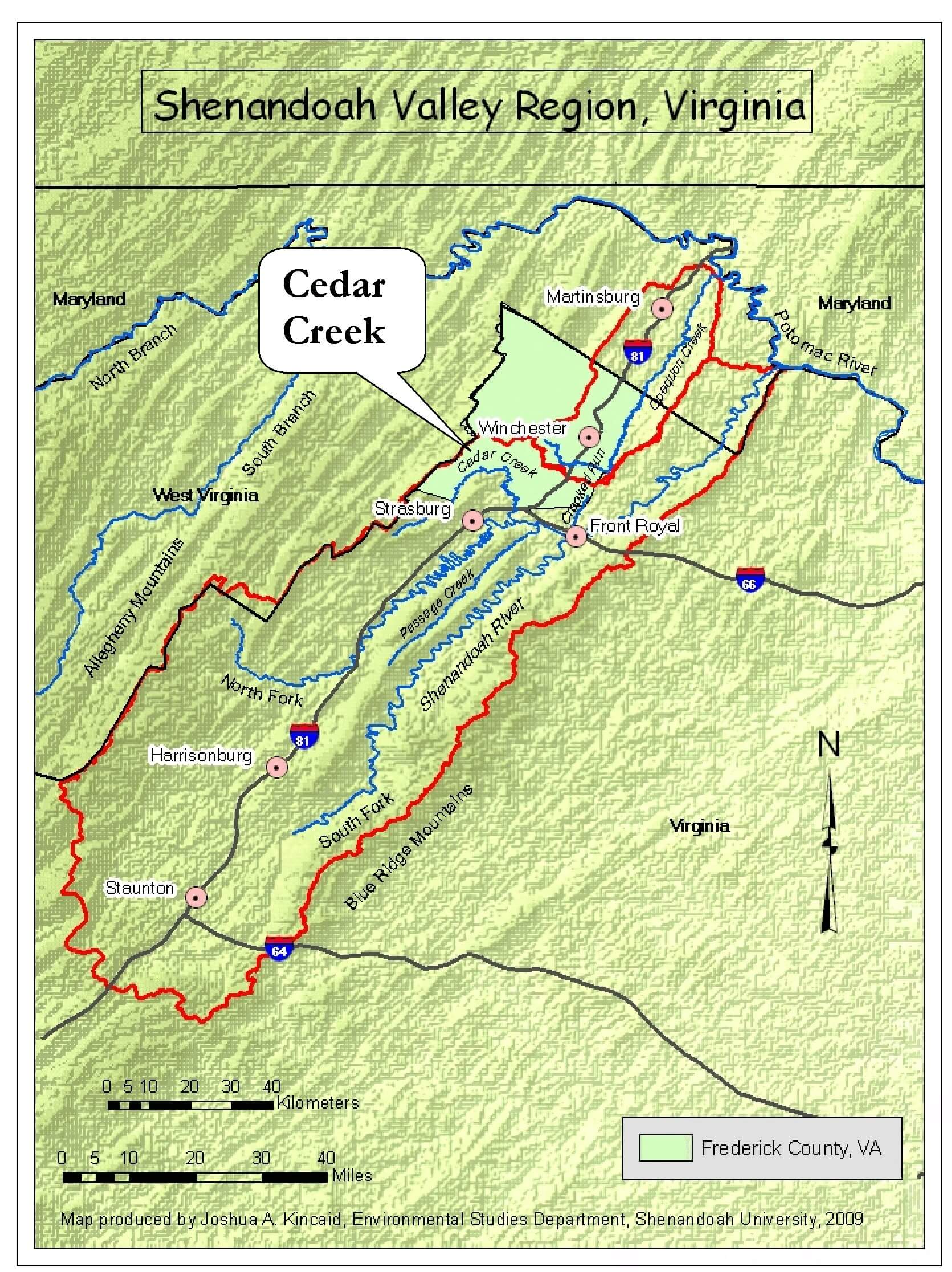
With an area of approximately 157 square miles, the Cedar Creek watershed encompasses portions of southwestern Frederick County, northern Shenandoah County, and a small part of Warren County. Cedar Creek’s upper reaches drain a trio of Allegheny Mountain ridges that are part of the George Washington & Jefferson National Forests. Near the community of Marlboro, the creek leaves the mountains as it begins to cross the floor of the Shenandoah Valley.
For nearly half of its 39-mile length, Cedar Creek forms the natural boundary between Frederick and Shenandoah County. Its last three miles mark the boundary between Shenandoah and Warren County before the creek empties into the North Fork of the Shenandoah River, east of Strasburg.
From Great North Mountain’s high ridges and rocky promontories to the Shenandoah Valley’s sunny farm fields, shady forests and town parks, the Cedar Creek watershed exhibits a remarkable diversity of ecological settings and biological communities. The relative cleanliness of the stream and the quality of its surrounding watershed are reflected in the area’s many distinctive habitats and seldom-seen plant and animal species. The forests bordering Cedar Creek on the Belle Grove Plantation and Cedar Creek Battlefield properties, for instance, contain what could be the best displays of spring wildflowers in Frederick County.
Despite its location in a rapidly growing region, the Cedar Creek watershed is not nearly as disturbed by human development as most other portions of the Shenandoah Valley. Much of the integrity of its aquatic and terrestrial environments can be attributed to the stewardship of those who have lived on the land and managed its use. Today’s challenge is to maintain this quality in the face of increasing pressure from residential and commercial development, pollution sources from within and beyond the watershed’s boundaries, and competing priorities for our time, attention, and financial support.
(This description was excerpted from Shenandoah University’s 2004 report entitled The Cedar Creek Watershed. A Preliminary Assessment of its Aquatic and Terrestrial Communities in Frederick and Shenandoah Counties, Virginia. The entire report is available via the Projects and Reports link on this page. Photos of eagle chicks and nesting great blue herons are provided courtesy of the National Park Service, Cedar Creek & Belle Grove National Historical Park.)
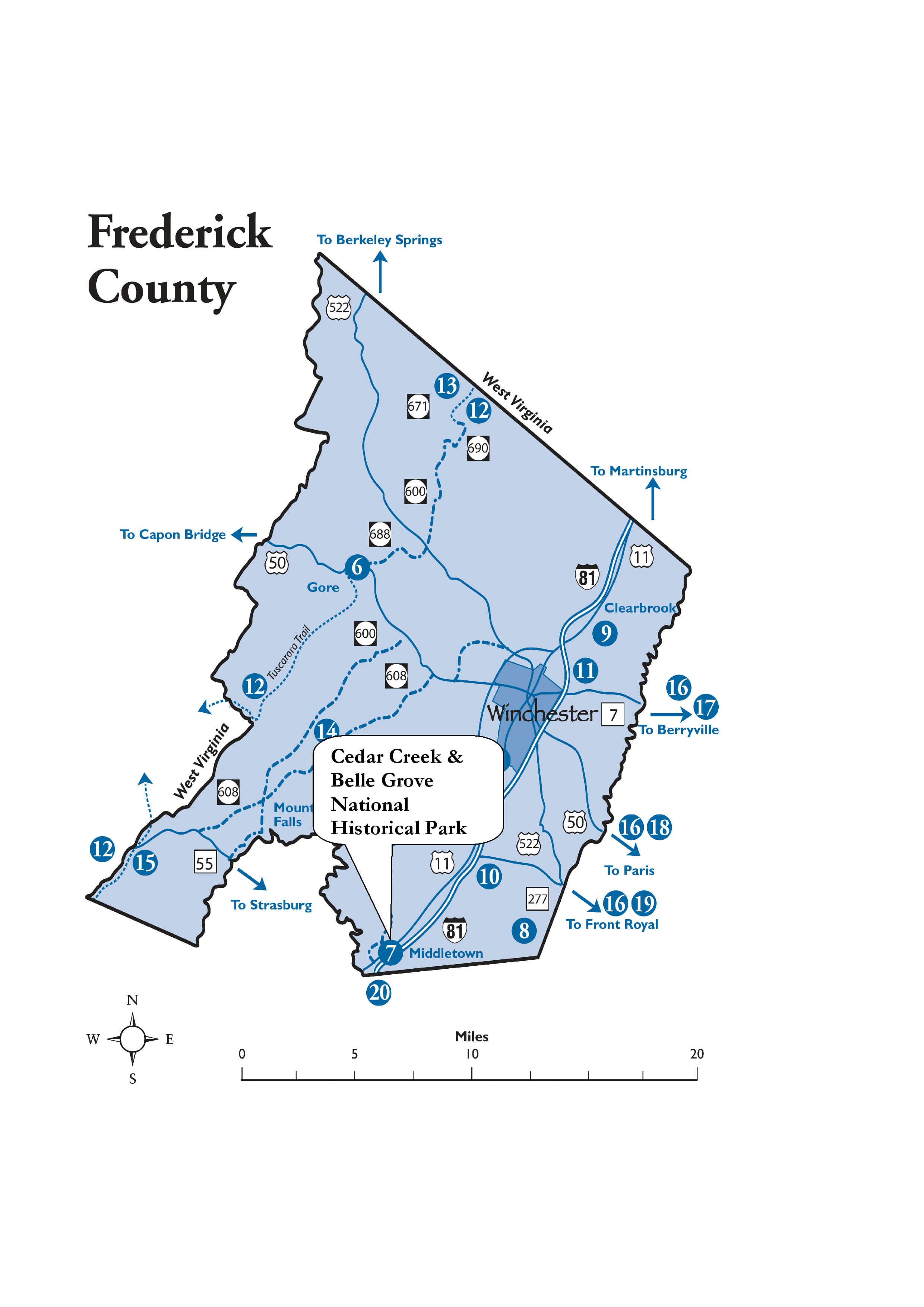
Directions:
Boat access to Cedar Creek is available at the Route 11 bridge (between Middletown and Strasburg) and the Minebank Road bridge (County Road 622, northwest of Middletown). Hikers can walk to the creek via the 1.2-mile trail through the Cedar Creek Battlefield from the New York Monument (request access permission from the Cedar Creek Battlefield Foundation headquarters on Route 11 south of Middletown).